Digital Twins
Powerful, interactive and inclusive tools for river basin water management
About
Freshwater systems are vital to sustaining human life, but must be intelligently managed in the face of climate change and pressures such as urbanization and overuse.
Digital twins, a virtual representation of a complex system used to facilitate intelligent decision-making, offer a solution.
The International Water Management Institute (IWMI) has mobilised partners to create working digital twins of river basins in Africa tailored to the needs of end users.
Water managers and other decision-makers can now access a interactive model of their river basin, a three-dimensional map overlaid with near real-time data, modelling and forecasting. AI assistants and augmented reality take usability to the next level.
Our framework offers a modular, field tested solution that can be replicated in river basins worldwide.
Transboundary river basin management
The Limpopo River Basin traverses South Africa, Botswana, Zimbabwe and Mozambique, supporting 18 million people who rely on its waters for domestic use, agriculture, industry, and ecosystems.
IWMI, in partnership with the Limpopo Watercourse Commission (LIMCOM), developed the Limpopo River Basin Digital Twin to enable science-based, transboundary decision making in the basin.
Flood preparedness, response and resilience building
The Dolo Ado district in Ethiopia’s Somali Region hosts over 200,000 refugees and local community members in one of East Africa’s most climate-vulnerable humanitarian zones.
IWMI, in collaboration with UNHCR, WFP and Somali Region authorities, developed the Dolo Ado Digital Twin as an interactive platform that simulates the region’s water systems, infrastructure networks and demographic dynamics in real-time.
Sub-Saharan Africa, MENA and South Asia
In these regions, water resources are shared across national borders and vulnerable to extreme events that cause displacement and conflict.
IWMI’s modular digital twin framework offers a flexible and scalable solution for multiple challenges, such as transboundary drought early warning systems, humanitarian planning dashboards, or agricultural water productivity monitoring.
We envision a global network of interconnected digital twins enabling equitable, climate-smart water governance across continents.
Our approach
For a digital twin to work across vast ecosystems in lower-to-middle income countries, many barriers must be overcome, including: sparse and unevenly distributed water monitoring systems; limited resources for water monitoring; lack of technical capacity; large geographical footprint of water systems; and complex governance and socioeconomic contexts.
IWMI’s Digital Twin framework overcomes these barriers by adopting a co-design approach with end users, working with partners to fill data gaps through innovation, leveraging 3D modelling and AI to create intuitive interfaces, and including local communities in data collection,.
By combining data from sensors, satellites, and historical records with advanced user interface designs, our digital twins offer unparalleled insights into the dynamics of river ecosystems.

Co-design
Working with water managers, decision-makers and citizen scientists
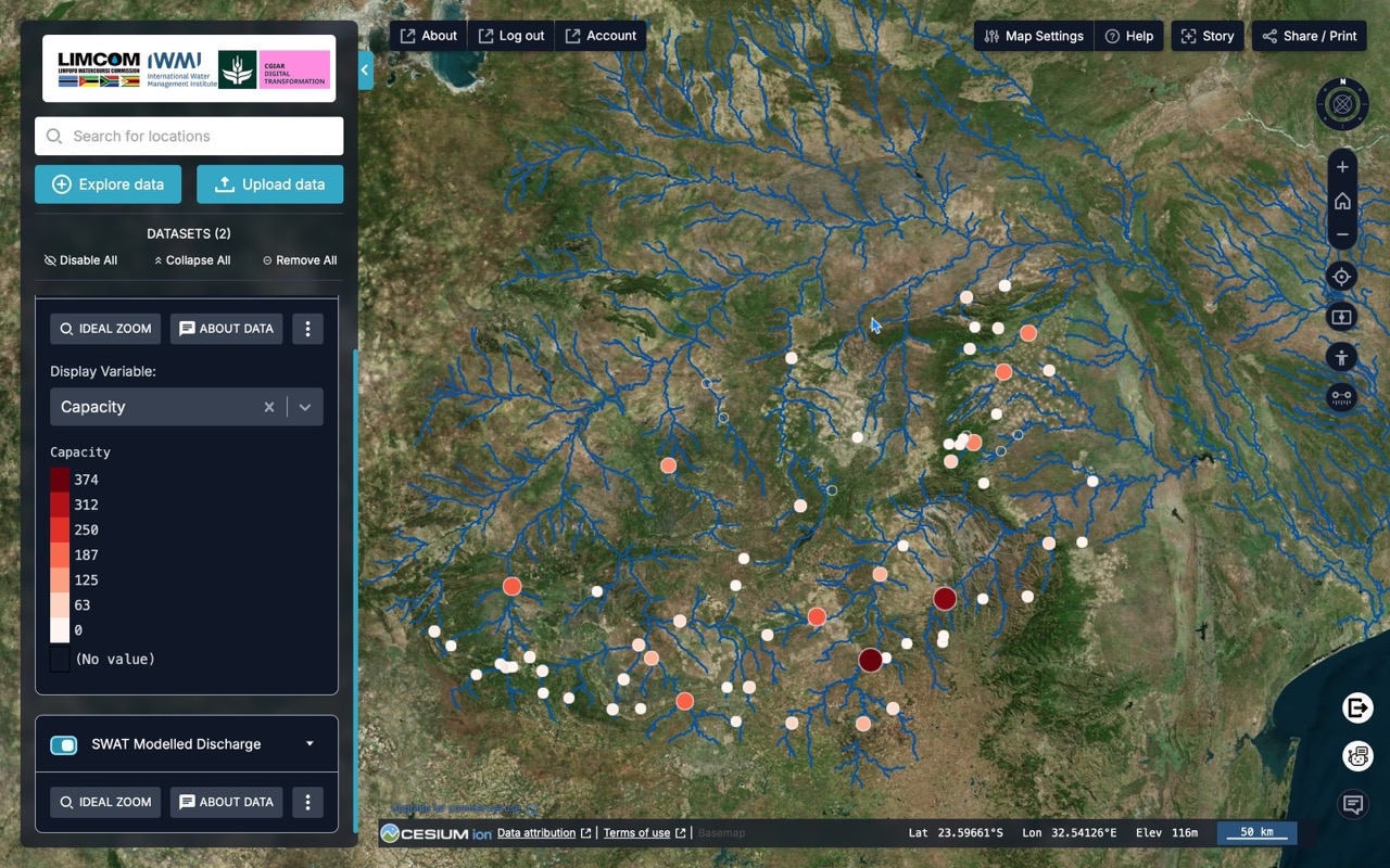
Open Data Cube
Innovating to fill data gaps
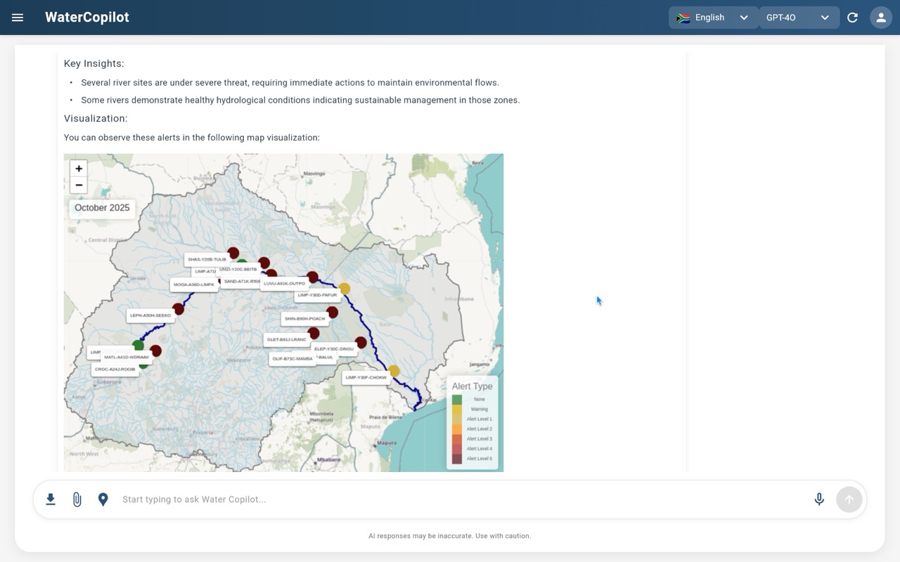
Foundational Models
SWAT hydrological models, scenario forecasting

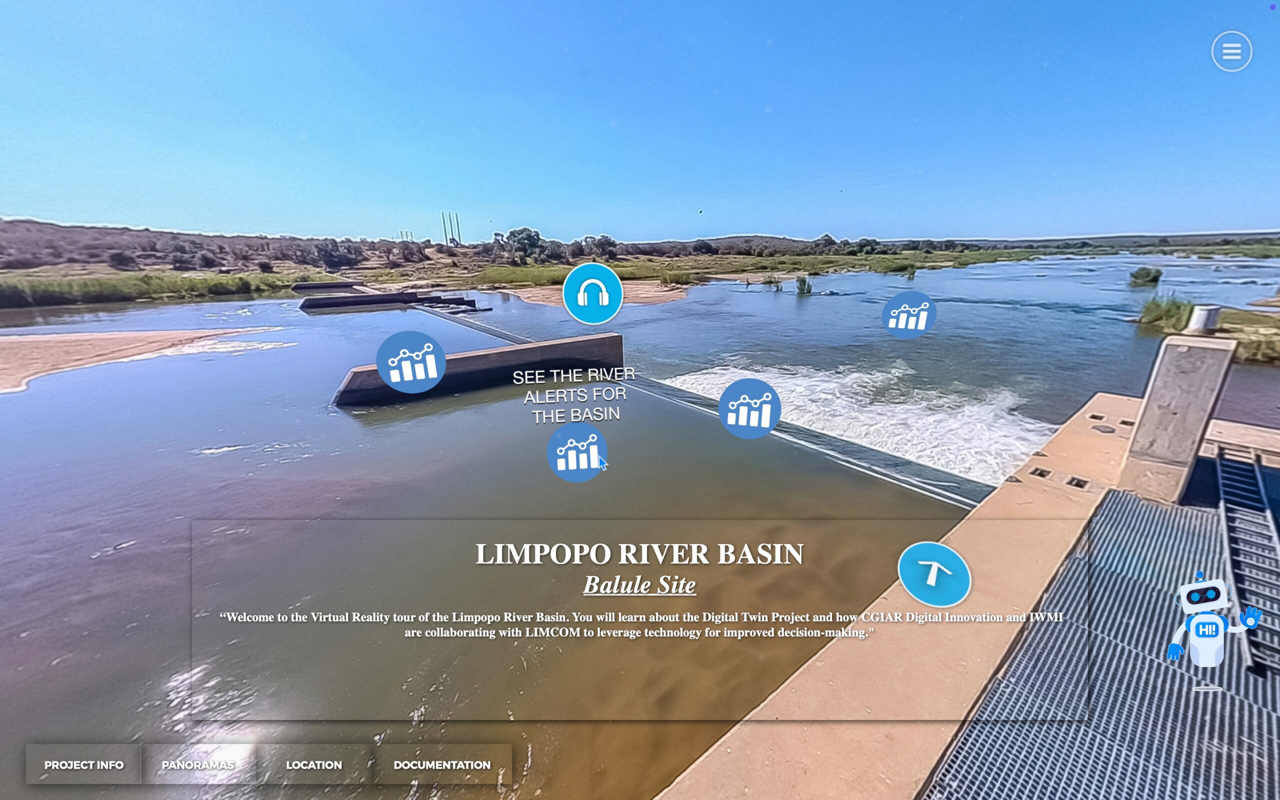
Interactive interfaces
3D modelling, augmented reality, AI agents
How it works
By providing a holistic view of river basin dynamics dynamics, a Digital Twin can help improve water resource management, enhance resilience to climate change, and ensure the long-term sustainability of ecosystems and communities dependent on the river.
The Digital Twin integrates data from various sources such as satellite imagery, ground sensors, weather forecasts, and historical records to create an accurate representation of the current state of the river basin.
Using advanced hydrological modeling techniques, the Digital Twin simulates how water flows through the basin under different scenarios, including rainfall patterns, land use changes, and human activities such as irrigation and dam operations. This allows stakeholders to understand how different factors affect the overall hydrological system.
The Digital Twin continuously monitors near real-time data from the river basin and compares it with the simulated model. This enables stakeholders to detect anomalies, predict potential risks such as floods or droughts, and take proactive measures to mitigate them.
Based on the insights provided by the Digital Twin, decision-makers can evaluate different management strategies and interventions to optimize water resource management in the river basin. For example, they can assess the impact of building new dams, implementing water conservation measures, or restoring wetlands on the overall ecosystem health and water availability.
The Digital Twin serves as a collaborative platform where various stakeholders, including government agencies, water utilities, environmental organizations, and local communities, can interact, share data, and collectively work towards sustainable management of the river basin.
Human-centered design
End-users are involved from throughout the development process to co-create a system that meets their needs.
Get started
The IWMI Digital Twins Initative generates open access resources, APIs, datasets and tools to build on and replicate our framework anywhere in the world.


