About
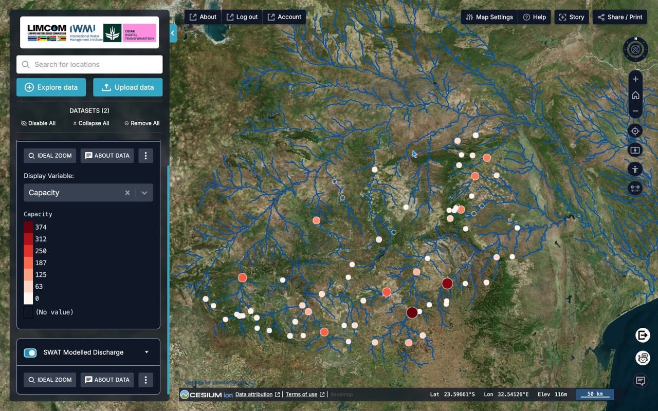
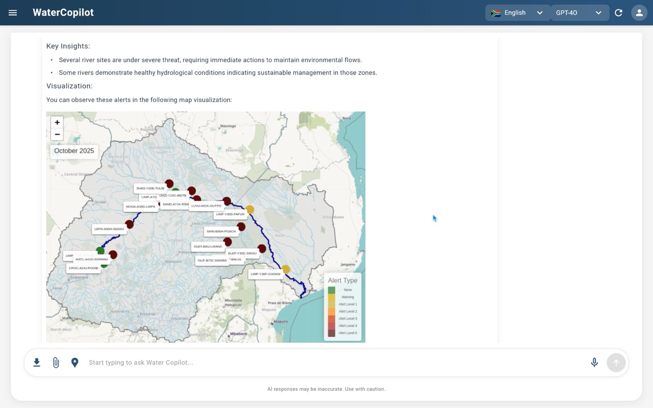
The Limpopo River Basin traverses South Africa, Botswana, Zimbabwe and Mozambique, supporting 18 million people who rely on its waters for domestic use, agriculture, industry, and ecosystems. The basin faces increasing pressures from overuse, pollution, drought and flooding. Coordinating water management across four national jurisdictions is complex, requiring near real-time data, shared forecasting tools and an inclusive platform for decision-making
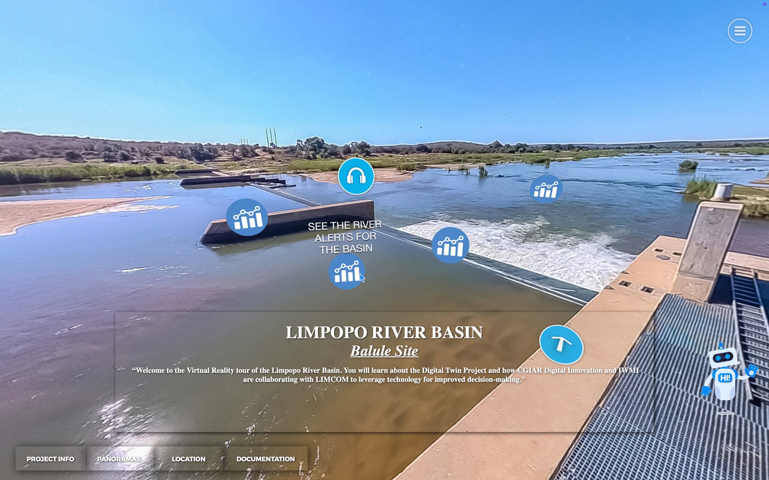
IWMI, in partnership with the Limpopo Watercourse Commission (LIMCOM), developed the Limpopo River Basin Digital Twin to enable science-based, transboundary decision making in the basin.
The system integrates 3D modelling, near-realtime monitoring, seasonal forecasting, scenario modelling and interactive visualizations allowing water managers to easily query and act on complex real-time data and forecasting thanks to a complete virtual representation of the basin supported by an AI Water Agent democratising information for all people of different backgrounds and disciplines.