Developing a SWAT Model for Limpopo River Basin
The Limpopo River Basin is a crucial water resource in southern Africa, spanning four countries: Botswana, Mozambique, South Africa, and Zimbabwe. To support sustainable water management in the region, the Limpopo River Basin Twin leverages the SWAT model, an advanced hydrological modeling tool. This model simulates the effects of land management practices on water, sediment, and agricultural chemical yields in large complex watersheds with varying soils, land use, and management conditions over long periods.
Hydrological Insights and Capabilities
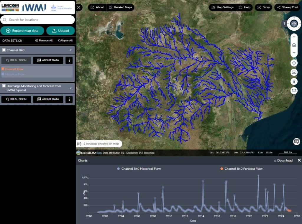
The SWAT model provides key insights into the hydrology of the Limpopo River Basin by simulating daily processes at the sub-basin level. With a catchment area of approximately 410,000 km², it incorporates data from 7 rainfall products, over 500 rainfall stations, 28 reservoirs, and numerous stream gauges to capture the temporal and spatial dynamics of water flow and storage.
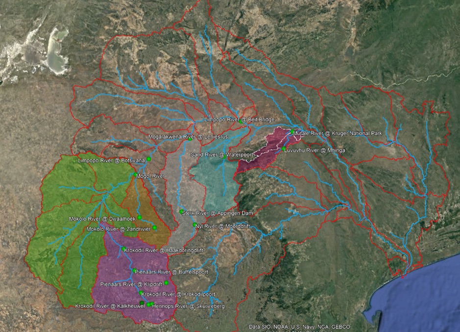
The model is calibrated for several major rivers within the basin, including:
- Mogalakwena River (R = 0.78, NS = 0.61)
- Krokodile River (R = 0.75, NS = 0.53)
- Mokolo River (R = 0.84, NS = 0.67)
These calibrations help ensure the accuracy of the model’s simulations, enabling better predictions of streamflow and water availability under different climatic scenarios.
Integration with Real-Time Data
The SWAT model within the Limpopo River Basin Twin is integrated with real-time monitoring systems. Data from satellite imagery, gauge stations, and Earth observation tools feed into the model, enabling continuous updates to water body statuses and reservoir levels. The Waterbodies Importer Tool and the Discharges Importer Tool play a vital role in ensuring that the SWAT model has the most up-to-date information for generating accurate forecasts.
